Leen Helmink Antique Maps
Antique map of South America by van Loon

Stock number: 19309
Zoom ImageCartographer(s)
Johannes van Loon (biography)
Title
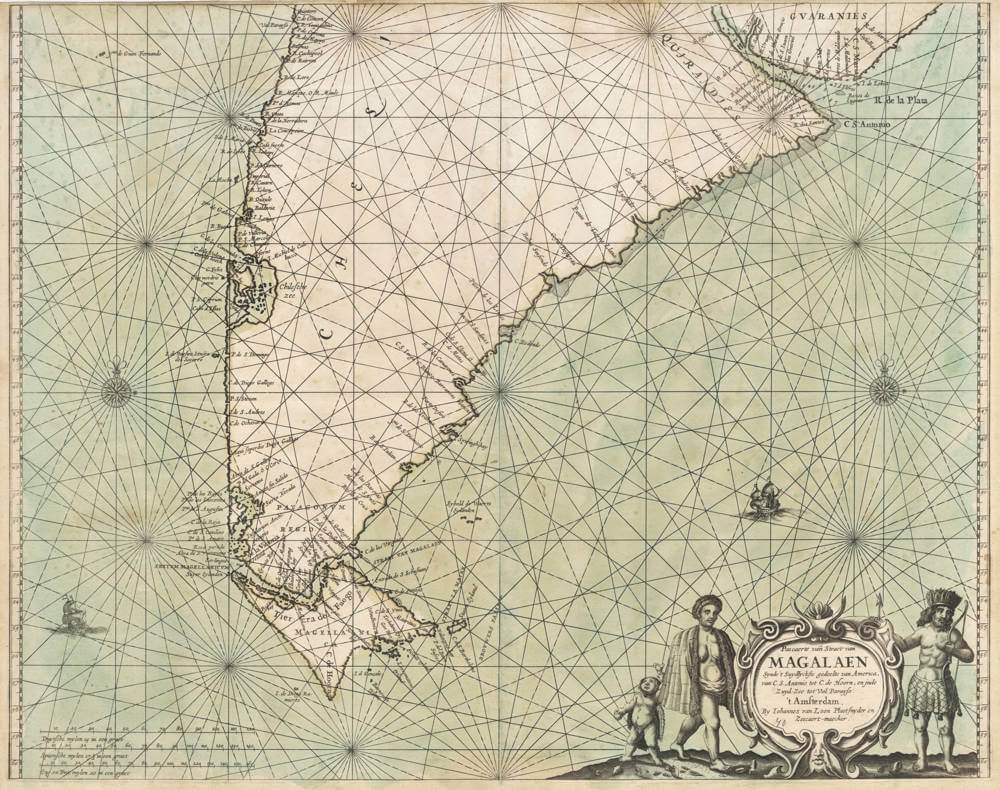
Pascaerte vande Straet van MAGALAEN Synde 't Suydlyckste gedeelte van America
First Published
Amsterdam, 1666
This Edition
1666
Size
42.5 x 54.0 cms
Technique
Condition
excellent
Price
$ 2,250.00
(Convert price to other currencies)
Description
Early Dutch navigation chart by Joannes van Loon, of utmost rarity and importance.
The sea chart is an original design by Johannes van Loon and would be an important prototype for many subsequent sea charts that were based on it.
The chart gives a detailed nautical view of the Dutch explorations and discoveries around Magellan's Strait, Magellanica, the Atlantic coasts of South America from Rio de Plata southwards and the Pacific coasts of South America from Valparaiso southwards.
Three scale bars are given, in Dutch, Spanish and English/French nautical miles.
Patagonian giants are depicted around the title cartouche.
Condition
Strong and even imprint of the copperplate. Upper margin short as issued. Attractive example of a seminal chart that is lacking in every collection.
Johannes van Loon (1611-1686)
Joannes van Loon was an accomplished mathematician and astronomer. His first cartographic involvements were with Theunis Jacobsz during the 1640s. From 1650 he worked with Joannes Janssonius, engraving amongst other worksthe plates for his Celestial Atlas by Cellarius, 1660.
In 1661 he published his first work with his brother, Gillis; the 'Zee Atlas' contained thirty-five maps. In 1666 the plates were Jan Jansson van Waesberge, with whom he then co-published the atlas. This edition was expanded to forty-seven maps, and by 1676 there were fifty.
(Burden)


