Leen Helmink Antique Maps
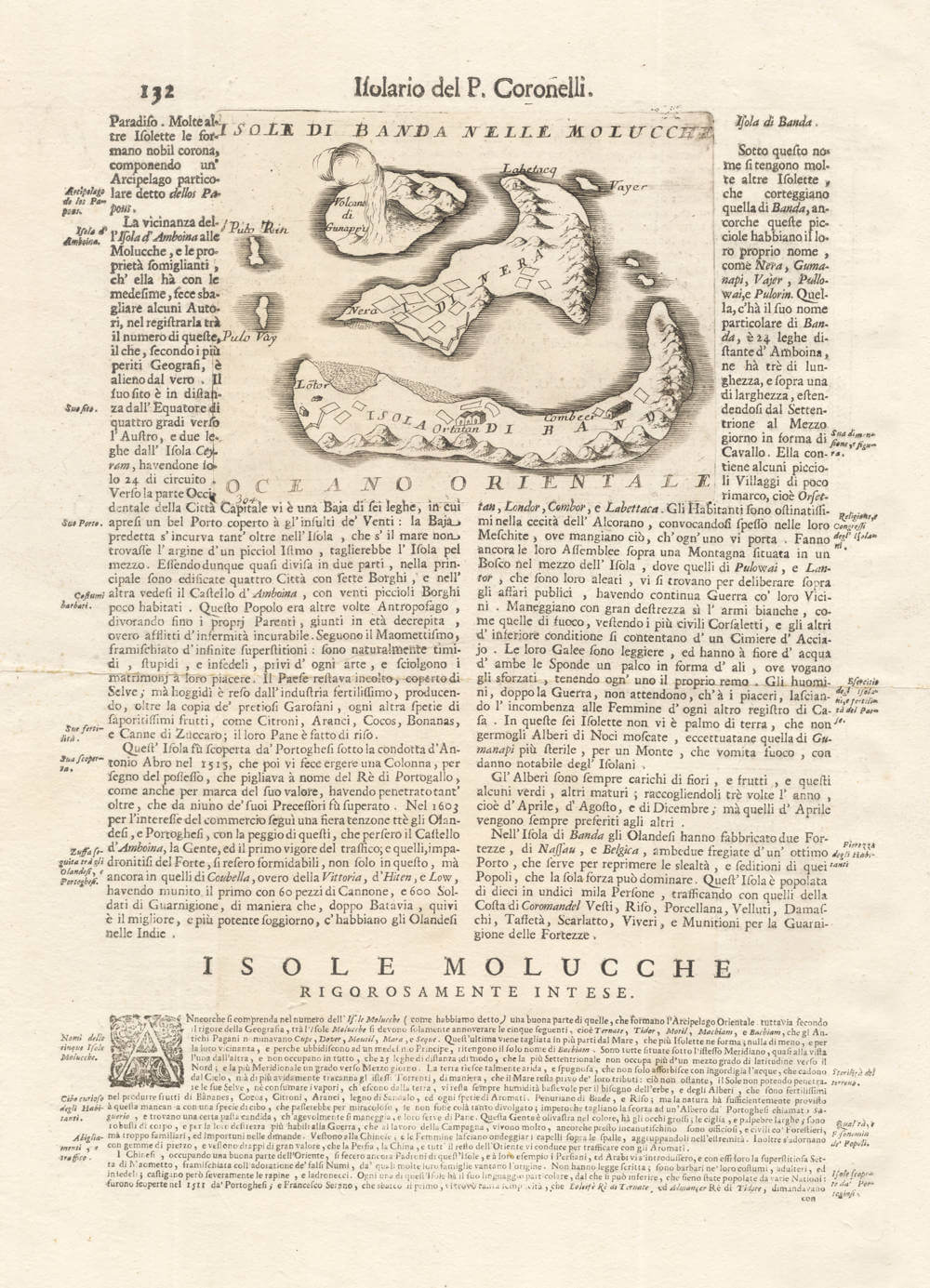
Antique map of the Banda islands by Vincenzo Coronelli
Stock number: 19955
Zoom ImageCartographer(s)
Vincenzo Maria Coronelli (biography)
Title
Isole di Banda Nelle Molucche
First Published
Venice, 1696
Technique
Condition
excellent
Price
$ 275.00
(Convert price to other currencies)
Description
Coronelli's small map of the Banda Islands, for his 1696 Isolario. Set in a page of letterpress text about the Spice Islands.
The significance of the islands is inseparable from the commercial and political history of the region. Until nutmeg cultivation was successfully established elsewhere in the tropics during the later eighteenth and nineteenth centuries, the Banda Islands were the world's sole source of nutmeg and its associated spice mace, both derived from the endemic Myristica tree; this monopoly of supply made the archipelago an object of intense European competition and lent strategic value to any accurate chart of its waters.
Geographical knowledge of Banda, Ambon, and Seram was deliberately controlled to protect the Dutch East India Company's commercial dominance, and the VOC enforced its monopoly with severity, including the destruction of spice trees on islands beyond its direct control.
To the west the chart includes Pulau Run (Pulo Rin), the small nutmeg-bearing island that became the "genesis" of English overseas colonies and the British Empire. English East India Company vessels first reached the Bandas in 1603, and in 1616 the inhabitants of Run, fearing Dutch encroachment, formally pledged allegiance to the English Crown, the island being held for the Company under Captain Nathaniel Courthope until his death and the eventual Dutch ascendancy. By the Treaty of Breda in 1667, England formally ceded Run to the Dutch in exchange for the retention of Manhattan, a settlement that secured the VOC's nutmeg monopoly while confirming English possession of what became New York. The chart is a first hand document of a contested and economically pivotal corner of the early modern world.
Condition description
Strong imprint of the copperplate. Set in a page of letterpress text touching into the copperplate image. Very wide margins as issued, clean paper, no cleaning or restorations.
Vincenzo Maria Coronelli (1650-1718)
Ordained as a Franciscan priest, Coronelli spent of his life in Venice, becoming a noted theologian an being appointed, in 1699, Father General of his order. By that time he was already famous as a mathematician cartographer and globe maker and his influence led to a revival of interest in these subjects in Italy at the end of the seventeenth century. He was certainly the greatest cartographer of his time there and became Cosmographer to the Venetian Republic, taught geography in the University and, in 1680, founded the first geographical society, the Academia Cosmografica degli Argonauti.
In his lifetime he compiled and engraved over 500 maps including a large 2-volume work, the Atlante Veneto, somewhat reminiscent of Robert Dudley's Dell' Arcano del Mare; he is equally well known for his construction of very large terrestrial and celestial globes even finer than those of Blaeu, including one, 15 feet in diameter, made for Louis XIV of France.
(Moreland and Bannister)
Related Categories
Related Items