Leen Helmink Antique Maps
Antique map of Batavia by Batavia

Stock number: 19433
Zoom ImageCartographer(s)
Jacques-Nicolas Bellin (biography)
Title
Batavia
First Published
Paris, 1753
This Edition
1760
Size
24.0 x 45.5 cms
Technique
Condition
mint
Price
$ 375.00
(Convert price to other currencies)
Description
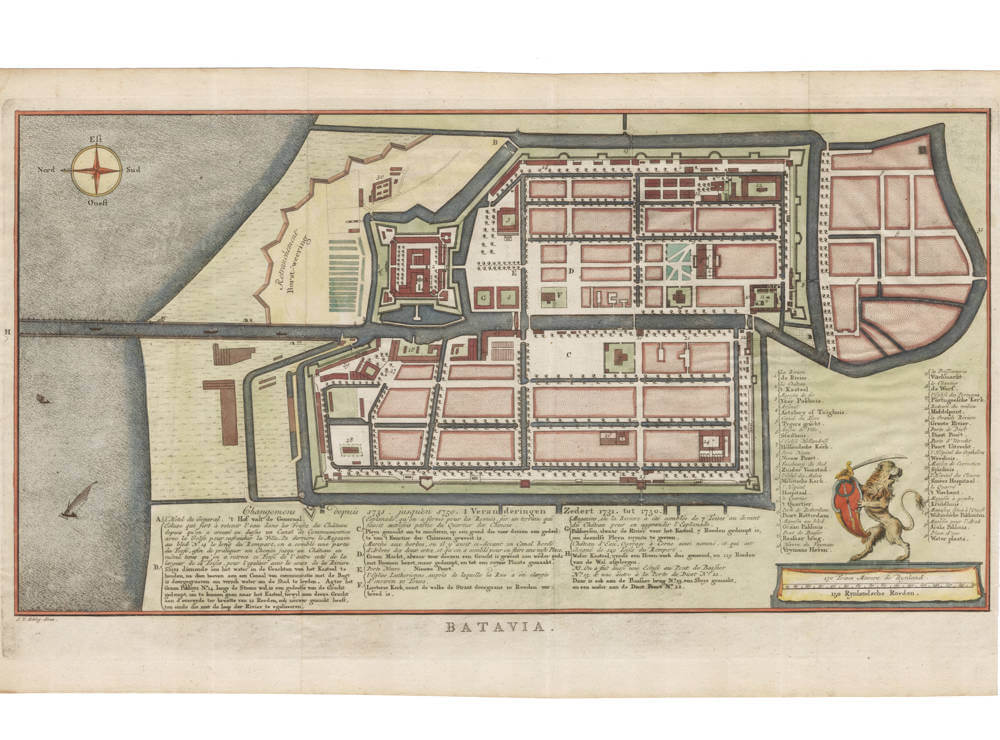
Early plan of Batavia, showing in detail the changes made between 1731 to 1750. With extensive legends in French and in Dutch. Coat of arms of Batavia in the lower left. North is at the left.
This is the very scarce Dutch derivative, engraved by van Schley for the Dutch edition of Prevost's Histoire de Voyages, published by Pieter Hondius (Pieter de Hondt) in the Hague.
Jakob van der Schley (1715-1779) was a Dutch draughtsman and engraver, who studied under Bernard Picart.
Jacques-Nicolas Bellin (1703-1772)
Jacques-Nicolas Bellin is arguably the most significant and influential publisher of charts in eighteenth century France.
Bellin was born in Paris. He was hydrographer of France's hydrographic office, member of the Académie de Marine and of the Royal Society of London. Over a 50-year career, he produced many maps of particular interest to the Ministère de la Marine.
In 1721, at age 18, he was appointed hydrographer (chief cartographer) to the French Navy. In August 1741, he became the first Ingénieur de la Marine of the Dépot des cartes et plans de la Marine (the French Hydrographical Office) and was named Official Hydrographer of the French King.
During his reign the Depot published a prodigious number of charts and maps, among which were large folio-format sea-charts of France, the Neptune Francois. He also produced a number of sea-atlases of the world, e.g., the Atlas Maritime and the Hydrographie Francaise. These gained fame, distinction and respect all over Europe and were republished throughout the 18th and even in the succeeding century.
Bellin also created smaller format maps such as the 1764 Petit Atlas Maritime (5 vols.) containing 580 finely detailed charts.
Bellin set a very high standard of workmanship and accuracy thus gaining for France a leading role in European cartography and geography. Many of his maps were copied by other mapmakers of Europe.
He was one of the Encyclopédistes, a group of 18th century intellectuals in France who compiled the 35-volume Encyclopédie which was edited by Denis Diderot and Jean le Rond d'Alembert. Bellin contributed 994 articles.
The Encyclopédistes, were part of the group called philosophes among whose members were the great minds of the Age of Enlightenment, e.g., Montesquieu, Voltaire, Rousseau, Baron d'Holbach.
(Wikipedia)


