Leen Helmink Antique Maps
Antique pre-Cook map of the world

Stock number: 19769
Zoom ImageCartographer(s)
Krevelt
Title
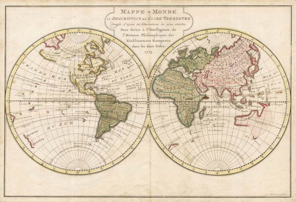
Mappe Monde ou Description du Globe Terrestre
First Published
Amsterdam, 1773
Technique
Condition
excellent
Price
$ 475.00
(Convert price to other currencies)
Description
One of the last pre-Cook maps of the world.
Important double hemisphere map of the world, published in Amsterdam at the dawn of Cook's voyages. Tentative coastlines fill in the unknown parts of Australia's southern and eastern coasts, otherwise following Tasman's discoveries of his two voyages of 1642/43 and 1644. Australia is named NOUVELLE HOLLANDE, with Tasmania named Terre de Diemen and New Zealand named NOUVELLE ZELANDE. The southern Indian Ocean has all the islands discovered by the Portuguese and the Dutch VOC, including Amsterdam, St Paul, Dina, Marseveen, Nachtegaal.
Several reported sightings of the mythical Southland or Antarctica are shown under South America ("Terre vue par F. Drake", seen in 1578 by Francis Drake), in the south Atlantic ("C. des Terres Australes", believed to have been seen by Amerigo Vespucci in 1503) and under South Africa ("C. de Circoncision", Bouvet Island, the world's remotest island, discovered in 1739 by Jean-Baptiste Charles Bouvet de Lozier).
Condition description
No restorations or imperfections. Nice original colour.
Related Categories
Related Items


