Leen Helmink Antique Maps
Antique map of Westcoast, Mexico by van Loon
The item below has been sold, but if you enter your email address we will notify you in case we have another example that is not yet listed or as soon as we receive another example.

Stock number: 18768
Zoom ImageCartographer(s)
Johannes van Loon (biography)
Title
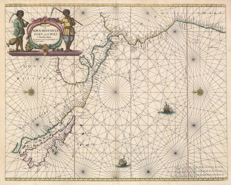
Pascaerte van Nova Hispania Peru en Chili
First Published
Amsterdam, 1661
This Edition
1668
Size
42.5 x 54.0 cms
Technique
Condition
excellent
Price
This Item is Sold
Description
Very rare Dutch sea chart by Joannes van Loon.
"This uncommon map appeared in the first edition of Joannes and Gillis van Loon's 'Zee Atlas'. It is derived from the Hendrick Doncker of 1659, although here its presentation is less cluttered, lacking the insets of the earlier map.
It improves on the Doncker by incorporating the east coast of Central America, a feature that Doncker would later add to his own. The nomenclature is largely similar, with the notable exception of the addition of 'P Sir Francisco Draco'. The South American coastline is extended further south.
There is just one known state."
(Burden)
Johannes van Loon (1611-1686)
Joannes van Loon was an accomplished mathematician and astronomer. His first cartographic involvements were with Theunis Jacobsz during the 1640s. From 1650 he worked with Joannes Janssonius, engraving amongst other worksthe plates for his Celestial Atlas by Cellarius, 1660.
In 1661 he published his first work with his brother, Gillis; the 'Zee Atlas' contained thirty-five maps. In 1666 the plates were Jan Jansson van Waesberge, with whom he then co-published the atlas. This edition was expanded to forty-seven maps, and by 1676 there were fifty.
(Burden)


