Leen Helmink Antique Maps
Antique map of the Pacific by Behaim
The item below has been sold, but if you enter your email address we will notify you in case we have another example that is not yet listed or as soon as we receive another example.

Stock number: 18708
Zoom ImageCartographer(s)
Behaim
Title
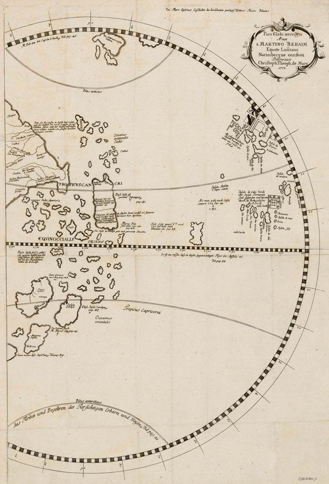
Pars Globi terrestris Ao. 1492 a Martino Behaim Equite Lusitano Norimbergae confecti Delineavit Christoph.
First Published
Gotha, 1778
This Edition
1778
Size
57 x 37 cms
Technique
Condition
excellent
Price
This Item is Sold
Description
Rare and fascinating map of the Indian Ocean and Pacific taken from Martin Behaim's 1492 Erdapfel, the earliest surviving terrestial globe.
Pre-Columbus view of China, South East Asia and Australia. Europe is on the right. America has not been discovered, as a result the Atlantic and Pacific are one ocean. Based on the 1492 Erdapfel by Martin Behaim, cosmographer for the Portuguese King John II.
Issued in 1778 by Christopher de Murr.
Related Categories
Related Items


