Leen Helmink Antique Maps & Atlases
www.helmink.com
Behaim
Pars Globi terrestris Ao. 1492 a Martino Behaim Equite Lusitano Norimbergae ...
Certificate of Authentication and Description
This is to certify that the item illustrated and described below is a genuine antique
map, print or book that was first produced and published in 1778, today 248 years ago.
July 14, 2026
Cartographer(s)
Behaim
First Published
Gotha, 1778
This edition
1778
Size
57 x 37 cms
Technique
Copperplate engraving
Stock number
18708
Condition
excellent
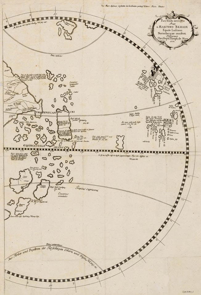
Description
Rare and fascinating map of the Indian Ocean and Pacific taken from Martin Behaim's 1492 Erdapfel, the earliest surviving terrestial globe.
Pre-Columbus view of China, South East Asia and Australia. Europe is on the right. America has not been discovered, as a result the Atlantic and Pacific are one ocean. Based on the 1492 Erdapfel by Martin Behaim, cosmographer for the Portuguese King John II.
Issued in 1778 by Christopher de Murr.