Leen Helmink Antique Maps
Antique map of North Atlantic by van Loon
The item below has been sold, but if you enter your email address we will notify you in case we have another example that is not yet listed or as soon as we receive another example.

Stock number: 18766
Zoom ImageCartographer(s)
Johannes van Loon (biography)
Title
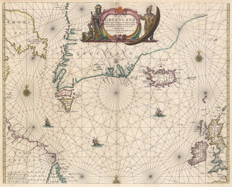
Pas-caerte van Groenland
First Published
Amsterdam, 1661
Size
42.5 x 53.0 cms
Technique
Condition
excellent
Price
This Item is Sold
Description
Johannes van Loon's very rare sea chart of the northern part of the Atlantic Ocean, from the British Isles to eastern Canada and the northwest passage. All charts by Joannes van Loon's Sea Atlas are of exceptional rarity.
"This uncommon chart of the North Atlantic waters is derived from Hendrick Doncker's of 1659, which in turn followed Pieter Goos' original design. The North American nomenclature is identical."
(Burden 364)
Johannes van Loon (1611-1686)
Joannes van Loon was an accomplished mathematician and astronomer. His first cartographic involvements were with Theunis Jacobsz during the 1640s. From 1650 he worked with Joannes Janssonius, engraving amongst other worksthe plates for his Celestial Atlas by Cellarius, 1660.
In 1661 he published his first work with his brother, Gillis; the 'Zee Atlas' contained thirty-five maps. In 1666 the plates were Jan Jansson van Waesberge, with whom he then co-published the atlas. This edition was expanded to forty-seven maps, and by 1676 there were fifty.
(Burden)


