Leen Helmink Antique Maps
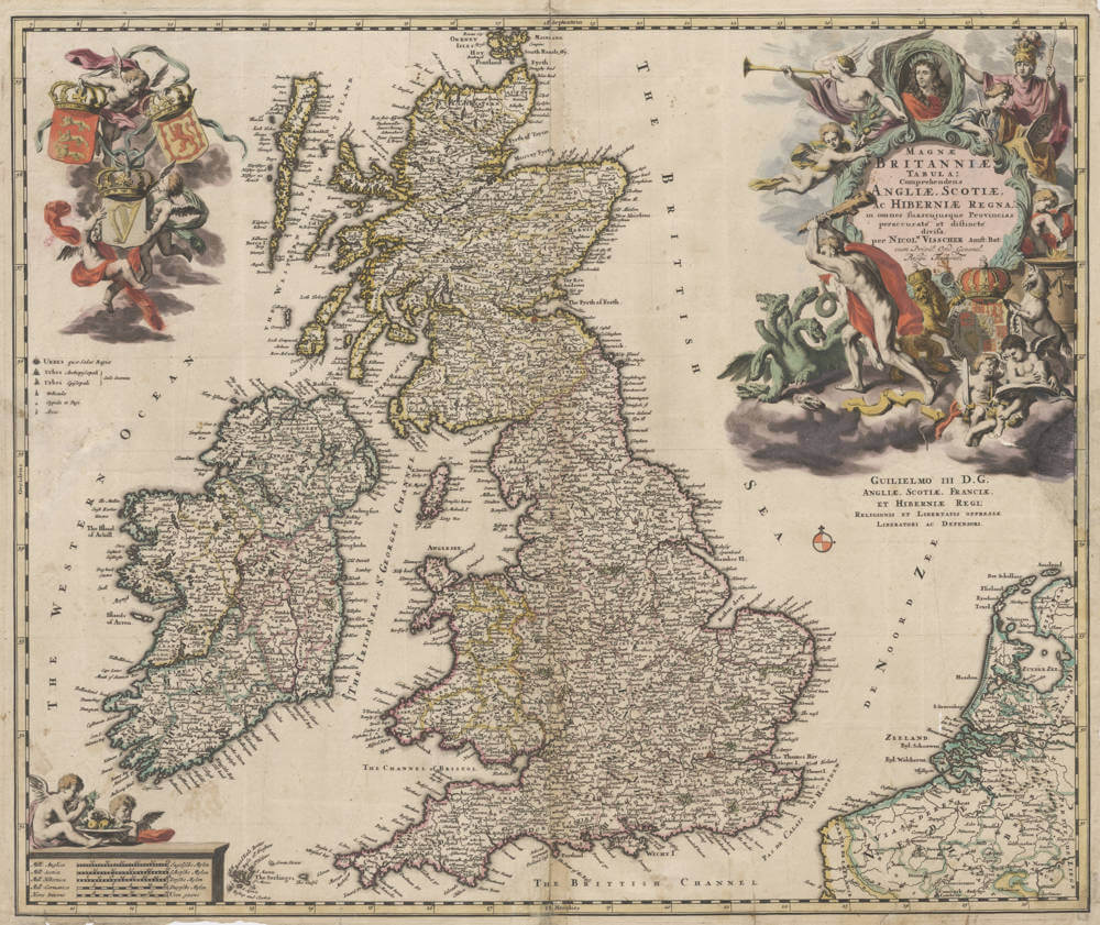
Antique map of the British Isles by Visscher

Stock number: 19473
Zoom ImageCartographer(s)
Nicolaes Visscher II (biography)
Title
Magnae Britaniae Tabula; Comprehendens Angliae, Scotiae, Ac Hiberniae Regna
First Published
Amsterdam, 1694
This Edition
1694
Size
47 x 56.5 cms
Technique
Condition
excellent
Price
$ 750.00
(Convert price to other currencies)
Description
Nicolaes Visser's second map of the British Isles, dedicated to King William III and quite distinct from Visscher's earlier map of Britain.
With highly decorative cartouches.
A very handsome example in attractive original coloring.
Claes Janszoon Visscher 1587-1652
Nicolaes Visscher I (son) 1618-1679
Nicolaes Visscher II (grandson) 1649-1702
Elisabeth Visscher (widow of N. Visscher II)
"For nearly a century the members of the Visscher family were important art dealers and map publishers in Amsterdam. The founder of the business, Claes Janszoon Visscher, had premises near to those of Pieter van den Keere and Jodocus Hondius whose pupil he may have been.
From about 1620 he designed a number of individual maps, including one of the British Isles, but his first atlas consisted of maps printed from plates bought from van den Keere and issued as they stood with some additions of his own, including historical scenes of battles and sieges for which he had a high reputation.
Some maps bear the latinized form of the family name: Piscator. After Visscher's death his son and grandson, both of the same name, issued a considerable number of atlases, constantly revised and brought up to date but most of them lacking an index and with varying contents.
The widow of Nicholaes Visscher II carried on the business until it finally passed into the hands of Pieter Schenk."
(Moreland & Bannister).


