Leen Helmink Antique Maps
Antique map of Sweden, Finland, Baltic by van Loon

Stock number: 18757
Zoom ImageCartographer(s)
Johannes van Loon (biography)
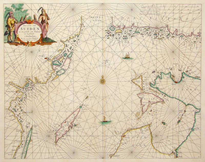
Title
Sueden
First Published
Amsterdam, 1661
This Edition
1668
Size
42.5 x 54.0 cms
Technique
Condition
excellent
Price
$ 2,400.00
(Convert price to other currencies)
Description
Johannes van Loon's very rare sea chart of Sweden and Finland.
All charts by Joannes van Loon's Sea Atlas are of exceptional rarity.
Johannes van Loon (1611-1686)
Joannes van Loon was an accomplished mathematician and astronomer. His first cartographic involvements were with Theunis Jacobsz during the 1640s. From 1650 he worked with Joannes Janssonius, engraving amongst other worksthe plates for his Celestial Atlas by Cellarius, 1660.
In 1661 he published his first work with his brother, Gillis; the 'Zee Atlas' contained thirty-five maps. In 1666 the plates were Jan Jansson van Waesberge, with whom he then co-published the atlas. This edition was expanded to forty-seven maps, and by 1676 there were fifty.
(Burden)


