Leen Helmink Antique Maps
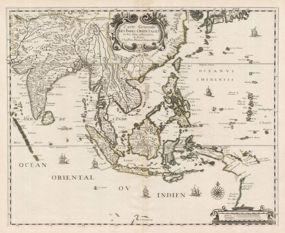
Antique map of South East Asia by Pierre Mariette
The item below has been sold, but if you enter your email address we will notify you in case we have another example that is not yet listed or as soon as we receive another example.

Stock number: 19453
Zoom ImageCartographer(s)
Pierre Mariette
Title
Carte Generale des Indes Orientales et des Isles Adiacentes
First Published
Paris, 1650
Size
44.4 x 58.2 cms
Technique
Condition
excellent
Price
This Item is Sold
Description
Scarce early map of the East Indies, published in Paris around 1650 by Pierre Mariette.
The map is based on the 1636 Henricus Hondius / Janssonius map of the region, which in turn is based on the 1632-1634 Blaeu / Gerritsz map of the area.
The map shows the Dutch landfalls and explorations in both Western Australia as well as Cape York.
All maps by Pierre Mariette are rare.


