Leen Helmink Antique Maps
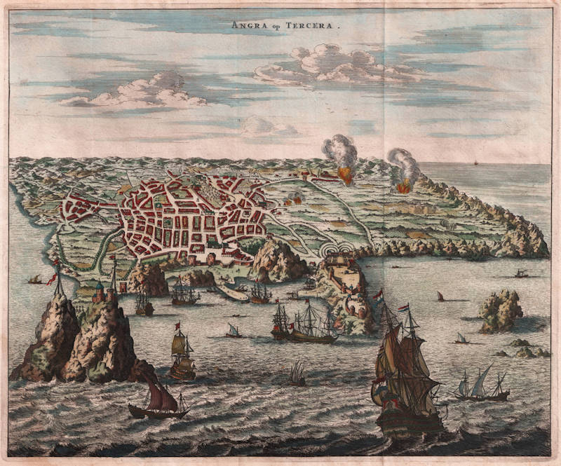
Antique map of Angra/Terceira (Azores) by Montanus/Ogilby
 by Montanus/Ogilby")
Stock number: 18811
Zoom ImageCartographer(s)
Montanus/Ogilby
Title
Angra op Tercera
First Published
Amsterdam, 1671
This Edition
1671
Size
29 x 35 cms
Technique
Condition
excellent
Price
$ 400.00
(Convert price to other currencies)
Description
"This beautiful engraving of Angra on Terceira depicts the city and its surrounds under attack by sea. Ships menace the harbor, and fires can be seen springing up in the fields beyond the city walls. The Portuguese stronghold on this key Atlantic port of call came under fire more than once in its history, and it is not clear which attack this particular view depicts.
The view is derived from the Linschoten and De Bry views of the 16th century, but additional fortifications have been added overlooking the bay."
(Martayan Lan)


