Leen Helmink Antique Maps
Antique map of Quantung, Fokien, Taiwan by Coronelli

Stock number: 18752
Zoom ImageCartographer(s)
Vincenzo Maria Coronelli (biography)
Title
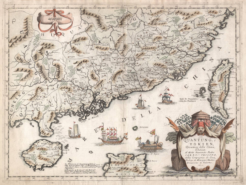
Quantung, e Fokien, Provincie della China
First Published
Venice, 1695
This Edition
1695
Size
46 x 61 cms
Technique
Condition
excellent
Price
$ 2,750.00
(Convert price to other currencies)
Description
A beautifully engraved decorative map of Southern China extending from Hainan in the West to Formosa in the East and centered on the Pearl River Delta with Macao and the islands around present-day Hong Kong.
The flamboyant decoration includes ceremonial Chinese barges and a large decorative gargoyle-like title cartouche lower right.
To the right a large Taiwan with many place names. Italian text on the reverse, including a description of Taiwan.
(Joppen).
Vincenzo Maria Coronelli (1650-1718)
Ordained as a Franciscan priest, Coronelli spent of his life in Venice, becoming a noted theologian an being appointed, in 1699, Father General of his order. By that time he was already famous as a mathematician cartographer and globe maker and his influence led to a revival of interest in these subjects in Italy at the end of the seventeenth century. He was certainly the greatest cartographer of his time there and became Cosmographer to the Venetian Republic, taught geography in the University and, in 1680, founded the first geographical society, the Academia Cosmografica degli Argonauti.
In his lifetime he compiled and engraved over 500 maps including a large 2-volume work, the Atlante Veneto, somewhat reminiscent of Robert Dudley's Dell' Arcano del Mare; he is equally well known for his construction of very large terrestrial and celestial globes even finer than those of Blaeu, including one, 15 feet in diameter, made for Louis XIV of France.
(Moreland and Bannister)
Related Categories
Related Items


