Leen Helmink Antique Maps & Atlases
www.helmink.com
van Loon
Pascaerte van Nova Hispania Peru en Chili
Certificate of Authentication and Description
This is to certify that the item illustrated and described below is a genuine antique
map, print or book that was first produced and published in 1661, today 364 years ago.
June 30, 2025
Cartographer(s)
van Loon
First Published
Amsterdam, 1661
This edition
1668
Size
42.5 x 54.0 cms
Technique
Copper engraving
Stock number
18768
Condition
excellent
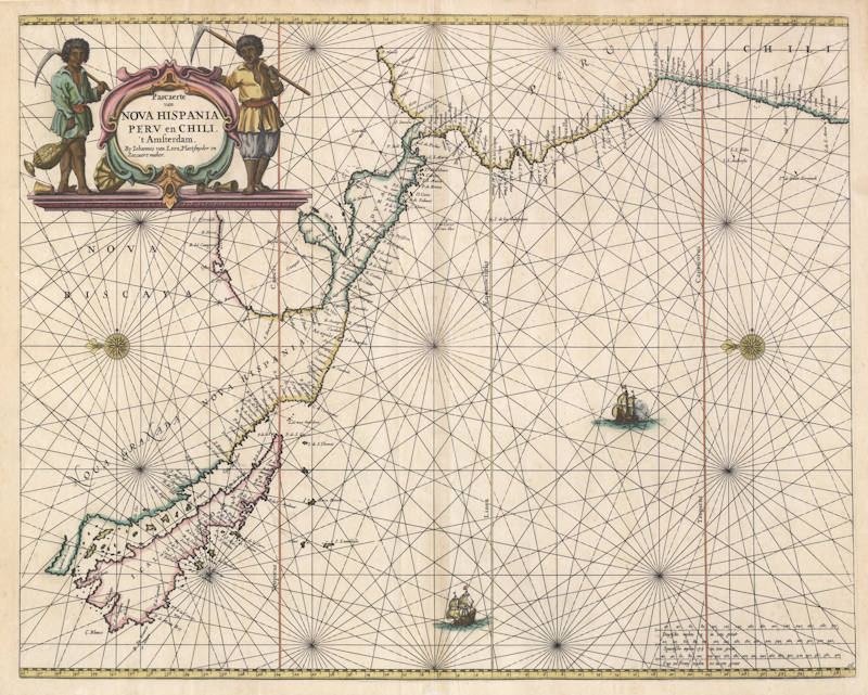
Description
Very rare Dutch sea chart by Joannes van Loon.
"This uncommon map appeared in the first edition of Joannes and Gillis van Loon's 'Zee Atlas'. It is derived from the Hendrick Doncker of 1659, although here its presentation is less cluttered, lacking the insets of the earlier map.
It improves on the Doncker by incorporating the east coast of Central America, a feature that Doncker would later add to his own. The nomenclature is largely similar, with the notable exception of the addition of 'P Sir Francisco Draco'. The South American coastline is extended further south.
There is just one known state."
(Burden)
Johannes van Loon (1611-1686)
Joannes van Loon was an accomplished mathematician and astronomer. His first cartographic involvements were with Theunis Jacobsz during the 1640s. From 1650 he worked with Joannes Janssonius, engraving amongst other worksthe plates for his Celestial Atlas by Cellarius, 1660.
In 1661 he published his first work with his brother, Gillis; the 'Zee Atlas' contained thirty-five maps. In 1666 the plates were Jan Jansson van Waesberge, with whom he then co-published the atlas. This edition was expanded to forty-seven maps, and by 1676 there were fifty.
(Burden)