Leen Helmink Antique Maps & Atlases
www.helmink.com
René de Renneville
Untitled [Mar di India]
Certificate of Authentication and Description
This is to certify that the item illustrated and described below is a genuine antique
map, print or book that was first produced and published in 1702, today 324 years ago.
June 26, 2026
Cartographer(s)
René de Renneville
First Published
Amsterdam, 1702
This edition
First state
Size
31.0 x 42.8 cms
Technique
copperplate engraving
Stock number
19811
Condition
excellent
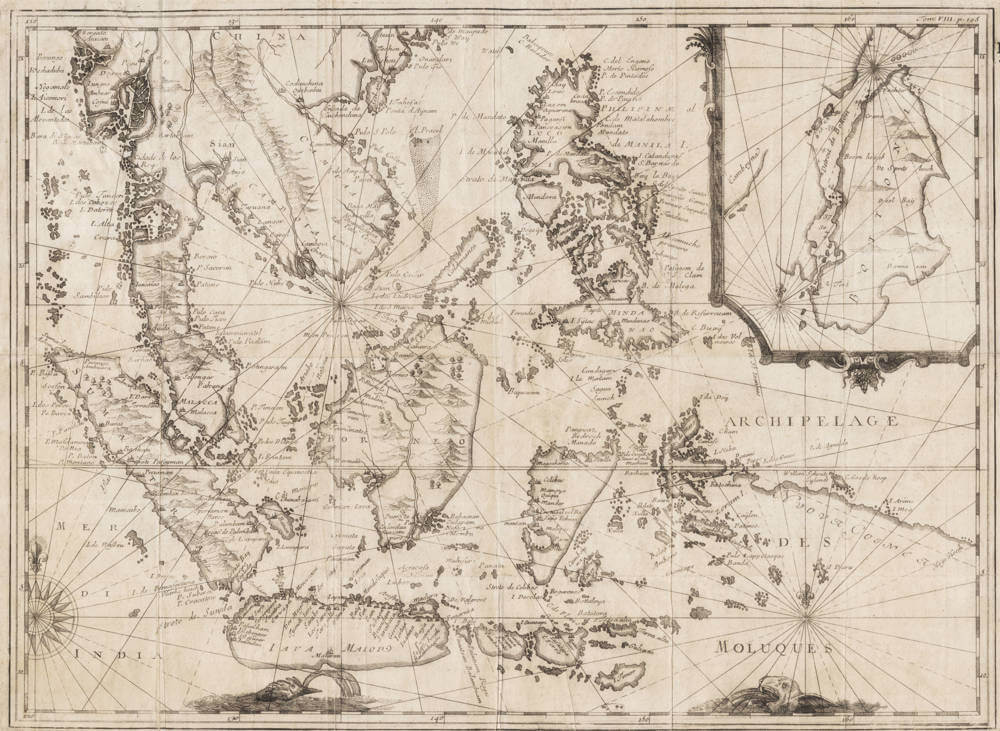
Description
Published in Amsterdam in 1702 within René de Renneville's 'Recueil de divers voyages curieux,' it is copied after Joris van Spilbergen's map in his 1619 travel account of his circumnavigation.
Like that map, it is untitled, and generally referred to as the 'Mar di India' after the name in the Indian Ocean in the lower left.
The map offers a detailed nautical chart of Southeast Asia's insular realm, encompassing the Malay Peninsula, Sumatra, Java, Borneo, Sulawesi (Celebes), the Moluccas, and the Philippine archipelago.
The upper right has an inset with the narrow Strait of Bouton, which was a dangerous but fast highway in the age of sail for the Dutch to get to the Philippines, Formosa and Japan.
Joris van Spilbergen's map was so important and innovative that there is also a version by Theodor de Bry, which does however not feature the Bouton Strait inset.
Rarity
The map is of utmost rarity.
Condition
Folds as issued. Excellent collector's condition.