Leen Helmink Antique Maps & Atlases
www.helmink.com
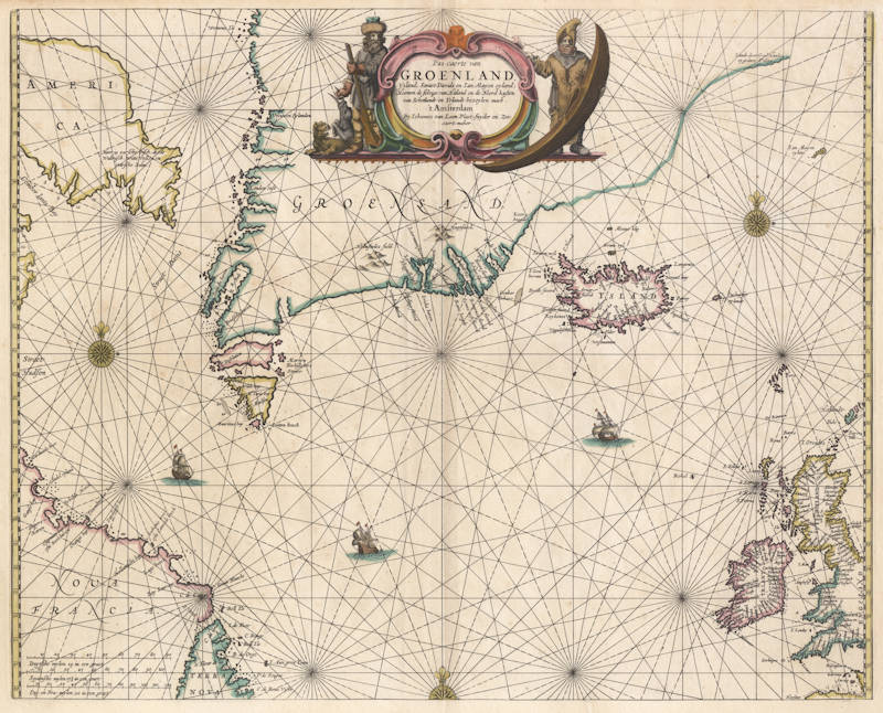
van Loon
Pas-caerte van Groenland
Certificate of Authentication and Description
This is to certify that the item illustrated and described below is a genuine antique
map, print or book that was first produced and published in 1661, today 365 years ago.
March 21, 2026
Cartographer(s)
van Loon
First Published
Amsterdam, 1661
This edition
Size
42.5 x 53.0 cms
Technique
Copper engraving
Stock number
18766
Condition
excellent
Description
Johannes van Loon's very rare sea chart of the northern part of the Atlantic Ocean, from the British Isles to eastern Canada and the northwest passage. All charts by Joannes van Loon's Sea Atlas are of exceptional rarity.
"This uncommon chart of the North Atlantic waters is derived from Hendrick Doncker's of 1659, which in turn followed Pieter Goos' original design. The North American nomenclature is identical."
(Burden 364)
Johannes van Loon (1611-1686)
Joannes van Loon was an accomplished mathematician and astronomer. His first cartographic involvements were with Theunis Jacobsz during the 1640s. From 1650 he worked with Joannes Janssonius, engraving amongst other worksthe plates for his Celestial Atlas by Cellarius, 1660.
In 1661 he published his first work with his brother, Gillis; the 'Zee Atlas' contained thirty-five maps. In 1666 the plates were Jan Jansson van Waesberge, with whom he then co-published the atlas. This edition was expanded to forty-seven maps, and by 1676 there were fifty.
(Burden)