Leen Helmink Antique Maps & Atlases
www.helmink.com
Allard
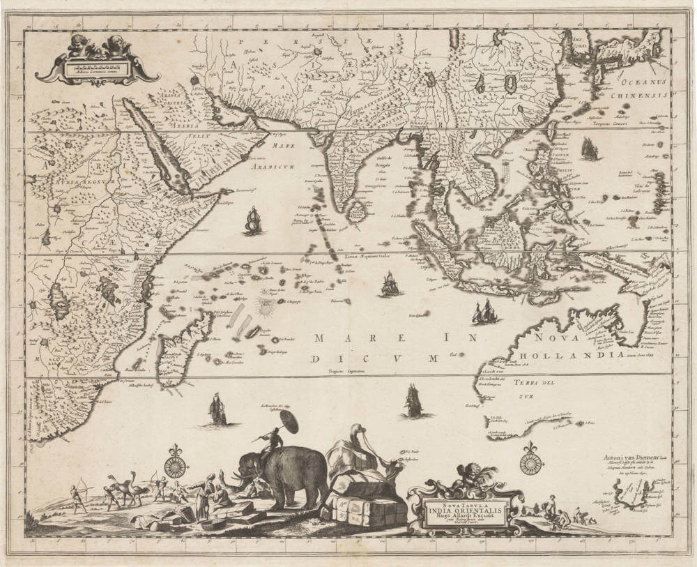
Nova Tabula Indiae Orientalis
Certificate of Authentication and Description
This is to certify that the item illustrated and described below is a genuine antique
map, print or book that was first produced and published in 1660, today 366 years ago.
July 16, 2026
Cartographer(s)
Allard
First Published
Amsterdam, 1660
This edition
Size
56.2 x 44.7 cms
Technique
Copper engraving
Stock number
19787
Condition
excellent
Description
Rare first state of 1660.
A highly spectacular and rare overview map of the East Indies, and a favorite of collectors.
Hugo Allard's exceptional map of the Orient is renowned for the decorative scenes along the bottom, resplendent with an elephant, camel, merchants and nomadic hunters chasing ostriches.
Here in the sought-after first state bu Hugo Allard Sr. The map was re-issued around 1697 in a second state with the impressum of his son Carel Allard.
The precise date is unknown, but it is considered to be from 1660, being one of the first printed maps to display the discoveries by Tasman.
The cartography of the East Indian islands: Insulae Indiae Orientalis
"The map is extremely decorative"
"A map that is much sought after by collectors"
(Parry)
Significance
Hugo Allard's map of the East Indies "with the elephant" is famous and sought-after because of the spectacular ethnographic scenes. It is one of the earliest printed maps to reveal Tasman's discovery of Tasmania and the north coast of Australia.
Rarity
Allard's publications were sold as loose sheets and are therefore of greatest rarity. Few have survived and are prized by collectors. The map is lacking in most collections.
Condition
Strong and even imprint of the copperplate. No restorations or imperfections. An excellent collector's example.