Leen Helmink Antique Maps & Atlases
www.helmink.com
de Fer
Planispheres Celeste Par Mr. de la Hire
Certificate of Authentication and Description
This is to certify that the item illustrated and described below is a genuine antique
map, print or book that was first produced and published in 1705, today 321 years ago.
July 26, 2026
Cartographer(s)
de Fer
First Published
Paris, 1705
This edition
Size
23.0 x 33.2 cms
Technique
Copper engraving
Stock number
19789
Condition
excellent
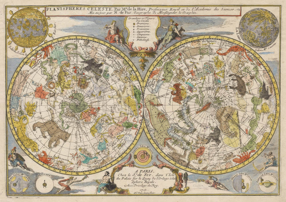
Description
Decorative double hemisphere celestial chart, centered on the north and south poles. The constellation figures are derived from the prototypes in Bayer's Uranometria and the spheres are surrounded by several diagrams of the sun, moon, and planets and mythical figures.
The constellations on the northern hemisphere are the designs from classical mythology. The newly discovered constellations on the southern hemispheres are after Plancius and Keizer, who meticulously charted and named them on the first Dutch fleet to the East Indies 1595-97.
Engraved by H.van Loon. After Philippe de la Hire, a notable French astronomer.
The map was included in only a few copies of Nicholas de Fer's L'Atlas Curieux ou le Monde, a composite atlas, and therefore rarely appears on the market. It is the first one we ever have one on offer.