Leen Helmink Antique Maps & Atlases
www.helmink.com
Jacobsz
Pascaerte van WESTINDIEN Van de Caribes tot aen de Golfo van Mexico
Certificate of Authentication and Description
This is to certify that the item illustrated and described below is a genuine antique
map, print or book that was first produced and published in 1650, today 376 years ago.
June 27, 2026
Cartographer(s)
Jacobsz
First Published
Amsterdam, 1650
This edition
1650
Size
43 x 54.5 cms
Technique
Copper engraving
Stock number
19125
Condition
excellent
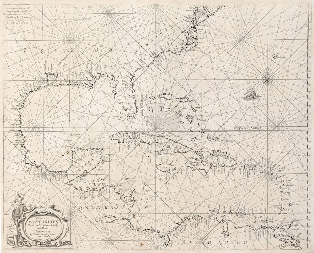
Description
The best sea chart for the 17th century pirates of the Caribbean.
Full Title:
Pascaerte van/
WEST INDIEN/
Van de Caribes tot aen de Golfo/
van Mexico/
t' Amsterdam/
By Theunis Iacobsz op 't water/
inde Lootsman.
Extremely rare chart by Theunisz Jacobsz, a cornerstone map that served as a prototype for all subsequent Dutch and English sea charts of the area. It was copied by all chart makers of the golden age. The chart may have been engraved as early as 1638, but little is known about the earliest date of Theunis Jacobsz's charts.
As with all of his charts, this is an innovative map, criss-crossed with loxodromes, a mileage scale for Dutch, Spanish, and English miles, and decorated with ships and compass roses.
It has a fascinating cartouche embellished with a navigator carrying navigation instruments: a pair of rulers, a set of charts, and a globe.
It is considered one of the best early sea charts of the area for collectors, in excellent condition, first and only known state, uncolored as issued.
The Mapping of North America
This chart by Theunis Jacobsz was most probably engraved close to his death in 1650. Although it is the school of Hessel Gerritsz, c.1631, like a number of his maps it is derived from Willem Blaeu's 'West Indische Paskaert', c.1630. There are differences, the most notable is the insertion of a Delaware Bay; in so doing the coastline nearby is much altered. The author has been unable to identify its origin.
Following his death the business was continued by his widow, Lijntje, until his sons, Caspar and Jacob, could take over. At least two atlases of this period are known bearing a small selection of maps by both Jacobsz and the young Frederick de Wit; they can be dated to c.1653-1654. This map is found in both, corroborating its existence by at least that date.
In 1666 Jacob Lootsman published the first known edition of the 'Nieuwe Water-Werelt, Ofte Zee-Atlas', which included this map. It was used as late as the 1681 issue, by which time a new plate was introduced.
(Burden)