Leen Helmink Antique Maps & Atlases
www.helmink.com
Cornelis Doedsz
Fragment of the "Indische Noord" [ Indian North ]
Certificate of Authentication and Description
This is to certify that the item illustrated and described below is a genuine antique
map, print or book that was first produced and published in 1600, today 426 years ago.
August 1, 2026
Cartographer(s)
Cornelis Doedsz
First Published
Edam, 1600
This edition
ca. 1600
Size
cms
Technique
Manuscript on vellum
Stock number
19022
Condition
fragment
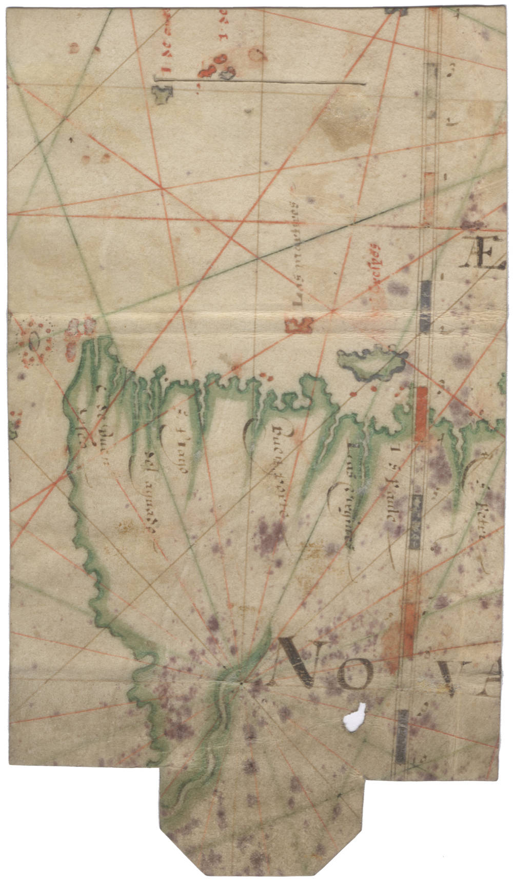
Description
New Guinea and Southland fragment of an early Dutch portolan chart on vellum of c.1600, of the Indische Noord, attributed to Cornelis Doedsz of the North Holland School of Cartography. They were the main suppliers of sea charts for all pre(cursor)-VOC companies, as well as for the VOC until they started their own in-house chartmaking.
Portolan charts of the North Holland School of Cartography are among the most decorative and sought-after portolans.
Rarity
Of exceptional rarity. Schilder lists two surviving charts of this typus.
Condition
Pen and ink on vellum, coastline in green, islands and rhumblines in red or green, vertical graticule in blue and red bisecting the word NOVA in the middle of the island, place names written in brown or red ink, 176 x 97mm at greatest extent, sometime trimmed and reused as a wallet-style wrapper, with closure tab irregularly cut out at foot and 42mm slot scored through at head (one small 6mm hole in blank area of the island, some scattered spotting).
Provenance
Ex Christie's London, Dec 2019, Lot 9.
Ex Collection Nico Israel.
LITERATURE
Günter Schilder, Early Dutch Maritime Cartography, Leiden, Brill, 2017.