Leen Helmink Antique Maps & Atlases
www.helmink.com
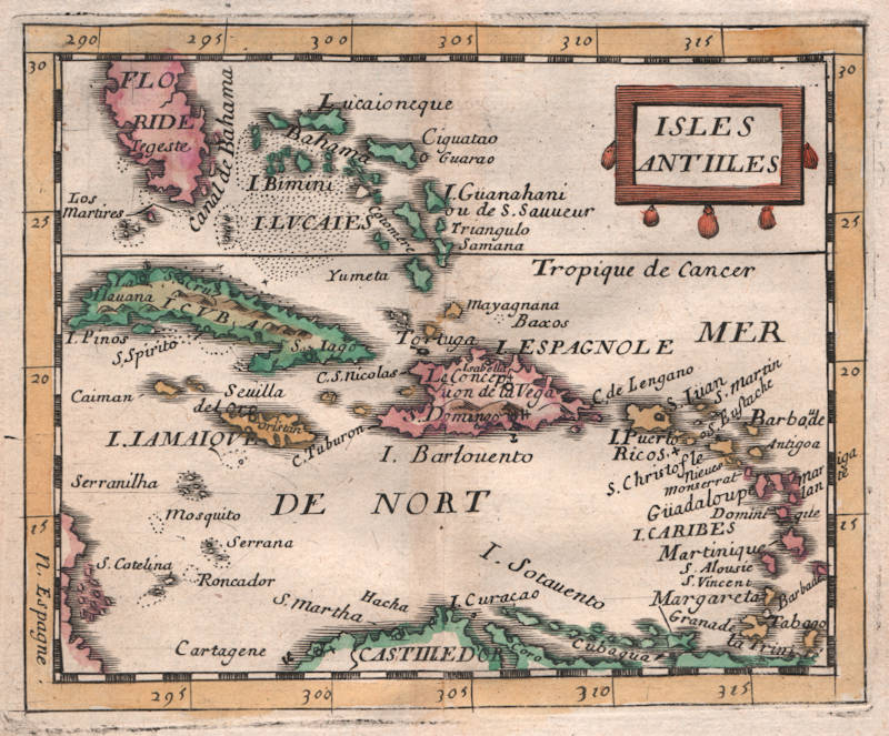
Pierre Du Val
Isles Antilles
Certificate of Authentication and Description
This is to certify that the item illustrated and described below is a genuine antique
map, print or book that was first produced and published in 1660, today 366 years ago.
July 4, 2026
Cartographer(s)
Pierre Du Val
First Published
Paris, 1660
This edition
1661
Size
9.8 x 12.1 cms
Technique
Copper engraving
Stock number
18748
Condition
excellent
Description
Duval's uncommon map of the Caribbean, with the tip of Florida. First state. Not in Burden.
Pierre Du Val (c.1619-1683)
Pierre Du Val was one of the most influential French mapmakers of the third quarter of the seventeenth century. He was the son-in-law and apprentice of Nicolas Sanson, the foremost French mapmaker of the period. From 1650, he was the official royal Geographer to the King of France Louis XIV, who had encouraged him to move to Paris. He published a wide range of atlases, individual maps of the world and the continents, as well as wall maps. His work was of great significance.