Leen Helmink Antique Maps & Atlases
www.helmink.com
Hendrick Doncker II
Nieuwe Paskaart van het Ylandt Java als meede een gedeelt van Sumatra en ...
Certificate of Authentication and Description
This is to certify that the item illustrated and described below is a genuine antique
map, print or book that was first produced and published in 1705, today 321 years ago.
June 27, 2026
Cartographer(s)
Hendrick Doncker II
First Published
Amsterdam, 1705
This edition
1705 first and only edition
Size
43.6 x 70.9 cms
Technique
Copper engraving
Stock number
18734
Condition
mint
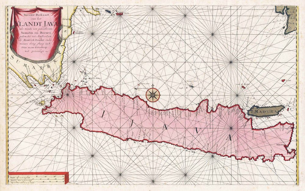
Description
Second copy known.
Highly detailed sea chart of Java, with many soundings and anchorages. Issued by Hendrik Doncker's son.
First and only edition, from the last and most advanced sea atlas ever produced by the Doncker publishing house, issued by Hendrik Doncker's son Hendrik (II). It contains 27 new charts, most of which are on increasing latitudes (Mercator Projection).
Hendrik Doncker senior had sold his copperplates and stock in 1693 to Johannes van Keulen, but after his death in 1699 his son Hendrik II issued an atlas with new charts. The atlas was not a commercial success and survives in one example only.
Hendrick Doncker (c.1626-1699)
Hendrick Doncker II (son) (c.1664-c.1739)
For about fifty years Hendrick Doncker ran a flourishing business in Amsterdam as a bookseller and publisher of sea atlases and textbooks on navigation. In a period when so many maps and charts were simply copied from other publishers, Doncker's charts were his own work and were noted for their accuracy and constant improvement. Apart from this work, he cooperated for many years with Pieter Goos and Anthony Jacobsz in producing a pilot guide 'De Zeespiegel'. Eventually his stock was sold to Johannes van Keulen.
(Moreland and Bannister)