Leen Helmink Antique Maps & Atlases
www.helmink.com
Ignatius Sichelbarth
Receiving the surrender of the Ili
Certificate of Authentication and Description
This is to certify that the item illustrated and described below is a genuine antique
map, print or book that was first produced and published in 1769, today 257 years ago.
June 19, 2026
Cartographer(s)
Ignatius Sichelbarth
First Published
Paris, 1769
This edition
1769
Size
52 x 90 cms
Technique
Copper engraving
Stock number
18706
Condition
excellent
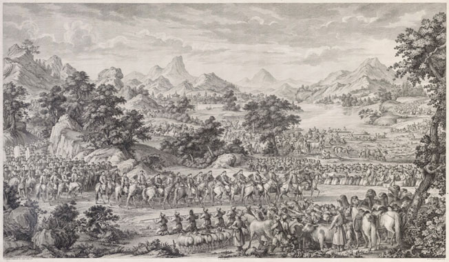
Description
Engraved by Prevost, from a drawing of 1765 by Jesuit Ignatius Sichelbarth, to commemorate the Emperor Qianlong's victory in Central Asia 1755-59. Unobtainable and important view. One of a rare series of sixteen views, engraved for Qianlong in France under the supervision of C.N. Cochin, celebrating the emperor's victory over the muslims of Eastern Turkestan (Xingiang). Large showpiece. Of exceptional importance and rarity.