Leen Helmink Antique Maps & Atlases
www.helmink.com
Acosta/Metellus
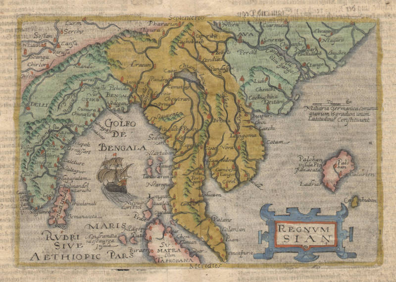
Regnum SIAN
Certificate of Authentication and Description
This is to certify that the item illustrated and described below is a genuine antique
map, print or book that was first produced and published in 1598, today 428 years ago.
August 3, 2026
Cartographer(s)
Acosta/Metellus
First Published
Cologne, 1598
This edition
Size
15.2 x 22.2 cms
Technique
Copper engraving
Stock number
18684
Condition
mint
Description
The first map dedicated to Thailand.
"Another milestone in Thailand’s cartographical development of the sixteenth century was the publication in 1596-8 of the first separate map of the kingdom, ‘Regnum Siam’ (in Speculum Orbis terrae) by Johannes Metellus, a German scholar, was based on information from maps by Gastaldi (1548) and Ramusio (1554).
The coastal outline of Thailand, the shape of the peninsula, and the placement of the mountains and rivers are similar to the Ramusio map. The shape of Lake Chiamay, however, is different and Ayutthaya was changed from its correct location to the northeastern part of the peninsula. The Gulf of Thailand is not named and its size is markedly reduced on this map. Also, it feature a Portuguese carrack sails towards the Straits of Malacca en route to Thailand."
(Rooney).