Leen Helmink Antique Maps & Atlases
www.helmink.com
Coronelli and Nolin
Royaume de SIAM, avec Les Royaumes qui luy sont Tributaires
Certificate of Authentication and Description
This is to certify that the item illustrated and described below is a genuine antique
map, print or book that was first produced and published in 1687, today 339 years ago.
October 17, 2026
Cartographer(s)
Coronelli and Nolin
First Published
Paris, 1687
This edition
Size
62.0 x 45.5 cms
Technique
Copper plate engraving
Stock number
18620
Condition
mint
Description
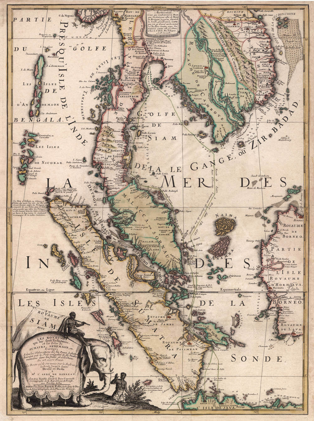
The large and spectacular "map with the elephant", a joint publication from a cooperation of Italian Jesuit and mapmaker Vincenzo Coronelli from Venice and publisher Jean Baptiste Nolin from Paris. The map title starts with "Royaume de Siam" and covers the Kingdom of Thailand, the Malay peninsula, Singapore, Cambodia, Vietnam, and Sumatra. It is one of the first and one of the few early maps to focus on this region, of which there are almost no 17th century maps. The maps of detail and accuracy exceeds everything that was published at the time.
The map is considered one of the most decorative maps ever, and it is of exceptional rarity and significance.
The design of the map is very pleasing, dominated by a striking title cartouche of a beautifully caprisoned elephant with native rider.
The historical importance of the map is high. By the 1660s, France had tried several times to seize the Dutch and English East India trade, but all efforts were expensive failures. It was not until 1664 that the French chartered their own East India Company, founded by Louis XIV, the Sun King or "Roi Soleil".
Because the English had a strong grip on British India, and the Dutch had a strong grip on the East Indies, France focused her attention on Indochina and Thailand, where the British and Dutch were less strong and less interested because of the lack of spices.
French embassies were sent to Siam shortly before the Kingdom effectively closed its doors to foreigners in 1688 and their records provide most of what is known about the region from that period.
Paris at the time had become a center of science, including cosmography and the determination of longitiude. With scientific, commercial, political, and religious aims all in mind, the French embarked on a series of embassies to the region, the first setting sail to Siam in 1685 with Chevalier de Chaumont as an envoy. Many scientific experiments were done, also to correct geography and to facilitate navigation. The expedition even had a veritable scientific laboratory on board, including many large telescopes and pendulum clocks, for better astronomical observations and to use the Lunar Eclipse of Dec 11, 1685 to determine the exact longitude of Siam.
Nolin used the results from this first French voyage to Siam that had just returned to France, and combined them with map details that were provided by Coronelli. The map records in detail the track and soundings of the French vessel in detail, through Sunda Strait and across the Gulf of Siam to the ancient capital Judia on the Menang River:
- "Route de Brest à Siam faite l'An 1685"
[Route from Brest to Siam done in the year 1685]
- "Route de Siam à Brest faite l'An 1686"
[Route from Siam to Brest done in the year 1686]
"Avec L'Oiseau Vaissaeu de Guerre de sa Majesté"
[With the Bird Vessel of War of his Majesty]
Soon after the embassy's return to to France in 1686 a number of accounts were published on its results, including this - now almost unobtainable - large and beautiful 1687 map of the region.
Rarity
The map is exceptionally rare because it was not issued in any atlas, but sold as a loose sheet at the time, by Coronelli in Venice and Nolin in Paris.
Vincenzo Maria Coronelli (1650-1718)
Ordained as a Franciscan priest, Coronelli spent of his life in Venice, becoming a noted theologian an being appointed, in 1699, Father General of his order. By that time he was already famous as a mathematician cartographer and globe maker and his influence led to a revival of interest in these subjects in Italy at the end of the seventeenth century. He was certainly the greatest cartographer of his time there and became Cosmographer to the Venetian Republic, taught geography in the University and, in 1680, founded the first geographical society, the Academia Cosmografica degli Argonauti.
In his lifetime he compiled and engraved over 500 maps including a large 2-volume work, the Atlante Veneto, somewhat reminiscent of Robert Dudley's Dell' Arcano del Mare; he is equally well known for his construction of very large terrestrial and celestial globes even finer than those of Blaeu, including one, 15 feet in diameter, made for Louis XIV of France.
(Moreland and Bannister)